
The last-mile crisis is an urban design problem, not just a technology race that drones alone can win.
- Delivery van congestion stems from a lack of parking infrastructure, not just the number of vehicles.
- Ground-based solutions like smart lockers and delivery droids form a critical, complementary layer to aerial logistics.
Recommendation: Urban planners must shift focus from single-vehicle solutions to designing a holistic logistical fabric that integrates ground, air, and data infrastructure.
The sight is now a permanent fixture of urban life: a delivery van, hazards flashing, double-parked on a narrow street, creating an instant bottleneck. As e-commerce continues its relentless growth, our cities are choking on the final, most expensive, and most carbon-intensive stage of delivery—the last mile. Many look to the skies, heralding autonomous drones as the silver-bullet solution that will clear our streets and deliver packages in minutes. This vision of a quiet, efficient future is compelling, but it dangerously oversimplifies the challenge.
The conversation is often dominated by a simple binary: futuristic drones versus polluting vans. While electric vehicles are a step forward, they don’t solve the core problem of physical space. The real crisis isn’t just about emissions; it’s about congestion, security, privacy, and how we use our shared urban environment. Simply replacing a four-wheeled vehicle with a flying one ignores the complex, interconnected system that governs the flow of goods through our communities.
But what if the answer isn’t a single technology, but a fundamental redesign of our urban logistical fabric? This article moves beyond the hype to offer a systemic view for urban planners and concerned residents. We will argue that solving the last-mile crisis requires an integrated strategy—one that harmonizes ground-level innovations like smart lockers and sidewalk droids with the emerging potential of aerial delivery. It’s about building a resilient, multi-layered network rather than betting on a single, disruptive hero.
To build this future, we must first dissect the present-day challenges, evaluate the full spectrum of available solutions, and then look ahead to the regulatory and infrastructural changes required. This guide provides a strategic framework for understanding these interconnected pieces, from on-the-ground traffic to the invisible lines of future zoning maps.
Summary: A Systemic Planner’s View on the Future of Urban Delivery
- Why Are Delivery Vans Responsible for 30% of Urban Congestion?
- How to Use Smart Lockers to Prevent Package Theft and Missed Deliveries?
- Bike Couriers vs. Droids: Which Is Faster in Rush Hour Traffic?
- The Privacy Problem: What Happens When Drones Fly Past Your Bedroom Window?
- When Will Autonomous Delivery Be Legal in Residential Areas?
- How to Group Your Orders to Reduce Carbon and Packaging Waste?
- How to Read City Zoning Maps to Spot Future Highway Expansions?
- How to Identify Future Traffic Nightmares Before Buying a House?
Why Are Delivery Vans Responsible for 30% of Urban Congestion?
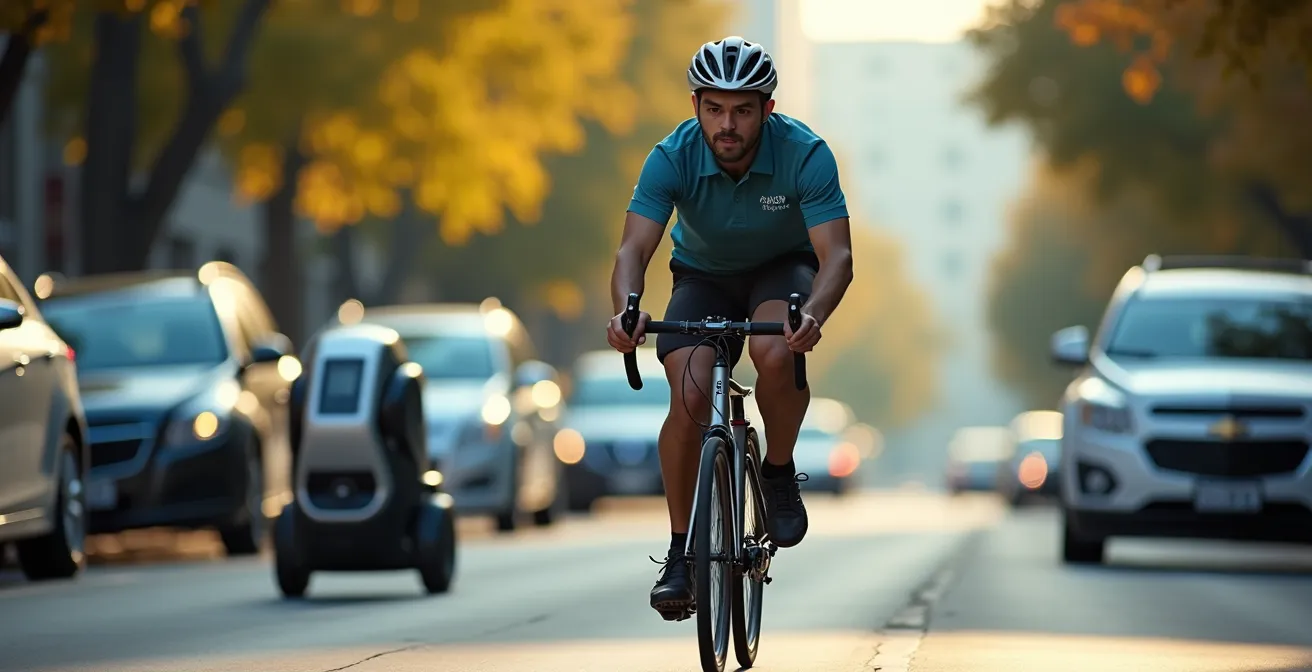
The delivery van has become a symbol of both convenience and congestion. While it’s easy to blame the sheer volume of e-commerce, the root cause is more specific: a fundamental mismatch between vehicle needs and urban infrastructure. The problem isn’t just the van itself, but the time it spends idle in traffic lanes while the driver searches for a safe place to stop. This search for parking is a critical friction point in the city’s logistical fabric.
Analysis shows that a significant portion of a van’s journey is unproductive. According to a World Economic Forum analysis, drivers can spend an average of 30 seconds per delivery just searching for parking. Multiplied by hundreds of stops per day, this time adds up to hours of double-parking, blocked bike lanes, and disrupted traffic flow. This single activity is a primary driver of the ripple effect that slows down entire city blocks.

As this image illustrates, the impact of one double-parked vehicle extends far beyond its physical footprint. It forces other vehicles to merge, slows public transit, and creates hazardous conditions for cyclists and pedestrians. The solution, therefore, isn’t just about replacing diesel engines with electric ones; it’s about redesigning curb space. The same WEF report highlights that strategically planned parking zones for commercial deliveries could reduce congestion by 3% and cut related carbon emissions by 9%. This infrastructure-first approach treats parking not as an afterthought, but as a crucial component of a functioning delivery network.
Ultimately, delivery vans contribute disproportionately to congestion because our streets were not designed for the high-volume, stop-and-go nature of modern e-commerce. Addressing this requires a shift in urban planning from simply managing traffic to actively designing for logistics.
How to Use Smart Lockers to Prevent Package Theft and Missed Deliveries?
While vans clog the streets, another major friction point occurs at the destination: the doorstep. Missed deliveries lead to re-attempts, doubling the traffic and emissions for a single package. Worse, unattended packages are prime targets for theft, a growing problem in dense residential areas. Smart lockers offer a simple yet powerful solution by creating a secure, consolidated, and asynchronous hand-off point. They function as a community-level infrastructure that decouples the delivery driver’s schedule from the resident’s.
Instead of making dozens of individual stops in a single apartment building or neighborhood, a courier makes one drop-off at a centralized locker bank. Residents receive a notification with a secure access code and can retrieve their packages 24/7 at their convenience. This model drastically improves efficiency, enhances security, and reduces the number of delivery vehicles needed on residential streets. By consolidating drop-offs, smart lockers directly attack the “time-spent-parking” problem that fuels congestion.
However, implementation requires more than just installing a steel box. To be truly effective, smart lockers must be integrated into the community’s fabric. This means placing them in high-traffic, accessible locations like transit hubs, grocery stores, or residential lobbies. Furthermore, ensuring equitable access is key; features like voice-guided interfaces for visually impaired users and community assistance programs can bridge the digital divide for elderly or less tech-savvy residents. When planned thoughtfully, these lockers can evolve from simple package receptacles into multi-purpose community hubs for local exchanges and consolidated returns, further strengthening local logistics.
Your Action Plan: Auditing a Site for a Community Logistics Hub
- Points of Contact Analysis: Map all existing delivery drop-off and pick-up points within a 500-meter radius (lobbies, mailrooms, porches) to identify patterns of high traffic and security vulnerabilities.
- Asset & Flow Inventory: Document the typical daily volume of packages, peak delivery times (e.g., Amazon vs. food delivery), and current security measures (e.g., concierge, camera coverage).
- Coherence Check: Compare potential locker locations against community values and master plans. Does the location promote walkability, accessibility (ADA compliance), and safety after dark?
- Usability & Access Audit: Evaluate the site for both digital and physical accessibility. Is there reliable cell service for app-based access? Is the physical path to the locker clear of stairs or obstructions?
- Integration & Scalability Plan: Develop a phased plan to integrate the locker with building management systems and outline priorities for expanding capacity or adding services like refrigerated storage based on demand.
By treating smart lockers as a piece of essential public infrastructure rather than a mere amenity, cities can build a more resilient and efficient ground-level delivery network—a necessary foundation before we can truly leverage the skies.
Bike Couriers vs. Droids: Which Is Faster in Rush Hour Traffic?
As cities seek alternatives to delivery vans, two ground-based contenders have emerged: the human-powered bike courier and the autonomous delivery droid. Both offer a low-emission, small-footprint solution for navigating dense urban cores, but they operate on fundamentally different principles. The choice between them isn’t about which is “better,” but which is best suited for a specific environment and task. A bike courier offers unparalleled operational flexibility, while a droid promises scalable, automated efficiency.
Bike couriers leverage human ingenuity to bypass gridlock, weaving through traffic, taking shortcuts through parks, and carrying packages up several flights of stairs. Their main advantage is adaptability. They can handle exceptions, interact with customers, and navigate complex building layouts that would stump a robot. In contrast, delivery droids—like those from Starship Technologies, which as an industry leader has reportedly completed over 5 million autonomous deliveries—are masters of the predictable. They stick to sidewalks, follow pre-programmed routes, and operate at a steady, reliable pace, making them ideal for routine deliveries in well-paved, accessible areas like college campuses or modern residential communities.
During peak rush hour, the bike courier almost always wins a point-to-point race, thanks to their ability to improvise. However, speed isn’t the only metric. Droids can operate for longer hours without fatigue and at a lower operational cost once the initial capital investment is made. The following comparison highlights the key trade-offs planners must consider.
This table breaks down the core differences between these two last-mile solutions, providing a framework for deciding which technology fits a city’s specific logistical needs.
| Criteria | Bike Couriers | Delivery Droids |
|---|---|---|
| Operational Flexibility | Can navigate stairs, handle exceptions | Limited to accessible pathways |
| Energy Efficiency | Human-powered, zero emissions | Electric battery, low emissions |
| Weather Resilience | Moderate (rider dependent) | Limited (sensor interference) |
| Cost Model | Gig economy, variable costs | High capital, low operational |
| Delivery Capacity | Medium loads, flexible routing | Small loads, fixed routes |
The optimal logistical fabric will likely incorporate both: nimble bike couriers for complex, time-sensitive deliveries and a fleet of steady droids for high-volume, predictable routes, working in concert to reduce street congestion.
The Privacy Problem: What Happens When Drones Fly Past Your Bedroom Window?
As we look to the sky for solutions, the conversation shifts from traffic congestion to a more personal concern: privacy. The idea of autonomous drones zipping through residential neighborhoods immediately triggers images of hovering cameras peering into private lives. This public perception is perhaps the single greatest barrier to widespread drone delivery adoption, even more so than technological or safety hurdles. For urban planners, addressing this “privacy problem” head-on with transparent policies and technology-driven safeguards is non-negotiable.
Leading drone delivery companies are acutely aware of this fear and are designing their systems to be “blind” by default. The primary navigation technology for many advanced drones is not high-resolution cameras but sensors like LiDAR (Light Detection and Ranging) and ultrasonics. These systems build a 3D map of the world using light pulses or sound waves, allowing the drone to detect and avoid obstacles without capturing any visual, personally identifiable information. The drone sees a world of points and shapes, not faces or license plates.
In an interview with Smart Cities Dive, the CEO of drone logistics company DroneUp, Tom Walker, directly addressed this issue, aiming to reassure the public. He stated:
The biggest concerns most people have initially are privacy and noise. [Our drones] don’t collect any video or photographs
– Tom Walker, DroneUp CEO Interview
Beyond non-visual navigation, a robust privacy framework includes several other layers of protection. Planners can work to establish designated “drone highways” or flight corridors that route traffic over commercial areas or parks, avoiding direct flight over residential backyards. Mandating specific flight altitudes can also minimize the sense of intrusion. On the data side, protocols for anonymizing flight path information and even establishing public data trusts to manage any collected environmental data can build public confidence that the system is designed for logistics, not surveillance.
By proactively designing and communicating these safeguards, cities can ensure that the convenience of aerial delivery does not come at the cost of personal privacy.
When Will Autonomous Delivery Be Legal in Residential Areas?
The question of when drones will legally and routinely deliver packages to residential homes doesn’t have a simple answer. It won’t be a single, nationwide “go-live” date, but rather a gradual, patchwork rollout governed by a complex web of federal aviation regulations and local municipal ordinances. From a planning perspective, the key is to understand that the path to full legalization is a marathon of certifications, pilot programs, and policy-making, not a sprint.
At the federal level in the United States, the Federal Aviation Administration (FAA) is the primary gatekeeper. The most crucial regulatory hurdle for any company wanting to operate a fleet of delivery drones is obtaining a Part 135 air carrier certificate. This is the same type of certification that traditional charter and cargo airlines must secure, and it signifies that the FAA has rigorously vetted the company’s operational safety, maintenance procedures, and training protocols. It essentially legitimizes a drone company as a certified airline.
A major milestone in this journey occurred in August 2020, when Amazon Prime Air received its FAA Part 135 certificate. This was a landmark moment, demonstrating a clear, albeit challenging, pathway for large-scale autonomous delivery operations. Since then, other players like Wing (owned by Google’s parent company, Alphabet) and Zipline have also achieved this status, paving the way for expanded commercial services. However, this federal certification is just the first step.
Even with FAA approval, companies must still navigate a maze of state and local regulations. Municipalities have authority over land use, noise ordinances, and public safety, giving them the power to designate where and when drones can take off, land, and fly. This is where urban planners play a pivotal role. They will be responsible for creating the “airspace zoning” policies that define drone routes, establish operational hours to mitigate noise, and designate locations for “vertiports” or landing pads. The legalization in your neighborhood will depend heavily on how proactive your local government is in creating this regulatory framework.
For now, expect to see continued expansion in select approved suburbs and communities that are actively participating in these advanced pilot programs, with broader urban deployment following as regulatory frameworks mature.
How to Group Your Orders to Reduce Carbon and Packaging Waste?
While logistics companies and city planners re-engineer the supply chain from the top down, consumers and communities have a powerful role to play from the ground up. A significant portion of last-mile inefficiency comes from the high frequency of small, individual orders. Every time you place a separate order for a single item, you trigger a distinct delivery event, complete with its own vehicle journey, driver time, and packaging. Shifting from an on-demand mindset to a consolidated ordering strategy is a powerful lever for reducing both traffic and waste.
The most straightforward approach is personal discipline: batching your needs into a single weekly or bi-weekly order. However, technology and community organizing can elevate this to a much more impactful level. Many e-commerce platforms now offer incentives for choosing a “delivery day,” allowing them to group shipments for an entire neighborhood into a single, more efficient truck route. This simple choice can have a significant collective impact on local traffic and emissions.
At a community level, the strategies become even more powerful. Residents in an apartment building or on the same block can coordinate to create shared delivery schedules or use services designed for bulk purchasing. The goal is to maximize the number of items per delivery stop. Here are some actionable strategies to implement this:
- Coordinate with neighbors to select weekly community delivery days for major retailers.
- Use predictive AI tools or subscription services to automate monthly bulk orders for non-perishable household staples like paper towels and cleaning supplies.
- Track your personal logistics impact through dedicated apps that visualize the carbon footprint of your delivery choices.
- Join or advocate for building-wide delivery consolidation programs managed by property management.
- Participate in emerging “white label” delivery services that consolidate packages from multiple retailers for an entire neighborhood into one daily drop-off.
This consumer-driven consolidation is a critical component of the systemic solution, proving that the responsibility and power to solve the last-mile crisis don’t rest solely with corporations and governments.
How to Read City Zoning Maps to Spot Future Highway Expansions?
For urban planners and savvy residents, a city’s zoning map is more than a dry legal document; it’s a blueprint for the future. These maps dictate what can be built where, and by learning to read their coded language, one can anticipate future development patterns, including major infrastructure projects like highway expansions or the emergence of new logistics corridors. This foresight is crucial for understanding how the logistical fabric of a neighborhood is set to evolve, long before the first construction vehicle arrives.
Spotting future highways isn’t about finding a dotted line labeled “Future Interstate.” The clues are more subtle and often lie in the intersection of zoning maps and other public documents, particularly a city’s Capital Improvement Plan (CIP). The CIP is a multi-year plan outlining all intended public infrastructure projects and their funding. By cross-referencing areas on the zoning map with projects listed in the CIP, you can identify corridors slated for major transportation upgrades.
Beyond the CIP, the zoning map itself holds vital clues about the future intensity of logistics. Here are key indicators to look for:
- Cross-reference zoning maps with Capital Improvement Plans (CIPs): This is the most direct way to connect planned funding to a specific geographic area.
- Identify mixed-use zones with specific height allowances: A sudden increase in permitted building height in a commercial or mixed-use zone can signal readiness for higher-density development, which will inevitably increase traffic and could even be a precursor for designated drone corridors.
- Track historical zoning data: Look for the rate of change. A neighborhood that has seen multiple rezoning approvals from residential to mixed-use or commercial in recent years is on a trajectory of rapid transformation.
- Look for easements along rail lines: Wide easements or undeveloped strips of land alongside existing freight rail lines are often reserved for future expansion, potentially for intermodal logistics hubs that connect rail to last-mile trucks or vans.
- Monitor rezoning from residential to mixed-use commercial patterns: This is a classic sign that a quiet area is being prepared for higher-traffic businesses, which will require significant delivery and logistics support.
The following table, based on common planning patterns, provides a rough guide to interpreting these indicators and their likely impact on future traffic.
This framework from a Texas A&M Transportation Institute analysis helps translate zoning language into a practical forecast of traffic impact.
| Zoning Indicator | Traffic Impact Likelihood | Timeline |
|---|---|---|
| Mixed-use rezoning | High | 2-3 years |
| Height allowance changes | Medium | 3-5 years |
| Rail easement modifications | High | 5-10 years |
| Commercial expansion zones | Very High | 1-2 years |
This analytical skill transforms you from a passive observer of urban change into an informed stakeholder, capable of predicting and adapting to the traffic of tomorrow.
Key Takeaways
- Last-mile congestion is fundamentally an urban design problem rooted in a lack of dedicated logistics infrastructure, not just a vehicle problem.
- A resilient delivery network requires a systemic integration of ground solutions (lockers, droids, couriers) and aerial technologies, managed as a single ecosystem.
- Proactive planning of physical infrastructure (curbside management) and digital policy (airspace zoning, data privacy) must precede the mass deployment of any new delivery technology.
How to Identify Future Traffic Nightmares Before Buying a House?
The dream of a quiet residential street can quickly turn into a nightmare if that street becomes a de-facto logistics artery. For prospective homebuyers and residents, understanding the hidden logistical currents of a neighborhood is just as important as checking school districts or property taxes. The consequences of ignoring them are significant; the 2025 Urban Mobility Report shows Americans lost an average of 63 hours annually just sitting in traffic, a number heavily influenced by the rise of last-mile deliveries.
Identifying a future traffic nightmare involves looking beyond the current state of a neighborhood and searching for signs of latent logistical potential. A large, undeveloped plot of flat land zoned for commercial use, even if it’s currently empty, is a prime candidate for a future “last-mile hub” or distribution center. Similarly, the proliferation of “ghost kitchens”—delivery-only restaurants operating out of industrial spaces—can drastically increase courier traffic on surrounding residential streets without any visible storefront.
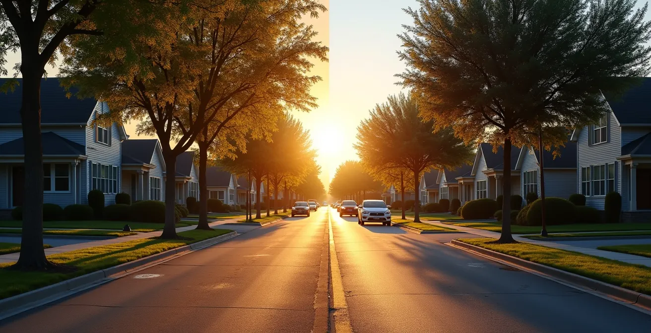
As this visual suggests, the tranquil character of a neighborhood can be fundamentally altered by logistical development that may not be immediately obvious. To conduct your own due diligence, consider this checklist:
- Analyze traffic data APIs for non-peak “logistics rush hours,” which often occur mid-morning and late evening, outside of traditional commute times.
- Identify proximity to potential last-mile hub locations by checking zoning maps for large, flat, commercially zoned parcels near highway access points.
- Check for ghost kitchens and high-traffic businesses on connecting routes using food delivery apps and business directories to see what’s operating behind the scenes.
- Monitor historical Google Maps traffic data for the area to see if traffic patterns have worsened over the past few years, indicating growing logistical pressure.
- Assess the property’s distance to major highways and commercial-zoned land, as these corridors are the lifelines of the delivery economy.
By learning to see your city through the eyes of a logistics planner, you can protect your investment and peace of mind. To truly shape the future of your community, take this knowledge and engage with your local planning department’s public meetings to advocate for smart, human-centered logistical growth.